At a glance
- Trekking in Purulia means day hikes on granite hills of roughly 450–700 m, not multi-day routes, and there are no waymarked trails.
- November to February is the season: by April, average daytime highs in Purulia town are about 37 °C.
- Chemtaburu above Khairabera Dam and Gorgaburu east of the Matha forest are the high points; Mayur Pahar and Pakhi Pahar are easy introductions.
- Go with a local guide, start early and be out of the forest before dusk, because elephant herds from Dalma move through these hills.
- Carry in all your water and food, and carry every scrap of plastic back out.
Trekking in Purulia means day hikes, not expeditions: short, steep climbs up the granite hills of the Ajodhya (Ayodhya) range, rocky forest paths down to waterfalls and walks between Adivasi villages on the plateau. The best season is November to February. There are no waymarked trails, so go with a local guide, start early, carry all your water, and be out of the forest before dusk, because elephant herds move through these hills.
What trekking in Purulia is really like
The Ajodhya Hills are the easternmost edge of the Chota Nagpur Plateau. The highest summits reach only about 700 m, and the reservoirs at their foot sit near 300 m, so most climbs gain a few hundred metres. What makes them hard work is the terrain: bare granite and gneiss, loose stones, thorny scrub and no shade on the upper slopes.
Paths are the ones villagers use to graze cattle and gather firewood, not signposted trekking routes. We have not found any published, measured route for most of the hills, and walking times depend heavily on the path a guide chooses. Treat any figure you read online with caution.
The reward is a landscape few people walk: dry deciduous forest of sal, palash, kusum, mahua and kend, red earth, granite domes, and views across the plateau to the reservoirs. Outlook Traveller's writer remembered college-day treks up Ajodhya Hill that started from the Matha forest bungalow, a few kilometres from where our cottages now stand.
The main hills and trails at a glance
| Hill or walk | Height | Road distance from the resort | What it involves |
|---|---|---|---|
| Matha Buru | about 478 m | 3 km | Rock-climbing ground; no documented public trail |
| Pakhi Pahar | about 480 m | 6.5 km | Guided walk among carved boulders and forest |
| Gorgaburu | 642–677 m (sources differ) | Near Paparkocha Dam, 16 km | Conical granite hill; guide essential |
| Chemtaburu | about 700 m | Via Khairabera Dam, 22 km | Steep ridge, popular with trekkers |
| Mayur Pahar | about 600 m | 20 km | Easy: road to the foot, then steps to a tower |
| Usuldungri | — | 29 km | Dawn drive from the hill top, short walk to a watch tower |
| Bamni Falls | — | 13 km | Steep descent on narrow, rough steps |
| Joychandi Pahar | — | 95 km | Several hundred steps to hilltop temples |
Chemtaburu: the high point above Khairabera
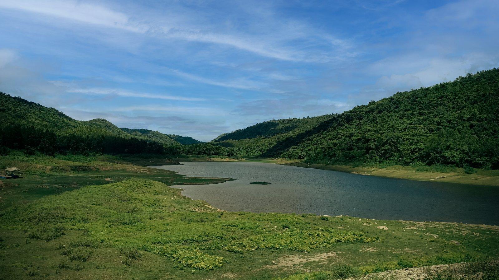
Khairabera Dam lies at the foot of Chemtaburu, usually given as the highest point of the Ajodhya range at about 700 m (Wikipedia gives both 699 m and 720 m, and some sources name Gorgaburu as the highest instead). In the local dialect chemta means flat and buru hill. The steep-sided ridge, shaped like a crocodile's back, is popular with trekkers but unsuitable for elderly visitors.
Plan it as a full morning: an early drive to Koreng village and the reservoir, the climb with a guide, then time by the water afterwards. The 2023 field study of the hills rated the lakeside easy to reach and Chemtaburu itself steep.
Gorgaburu: the conical hill east of Matha
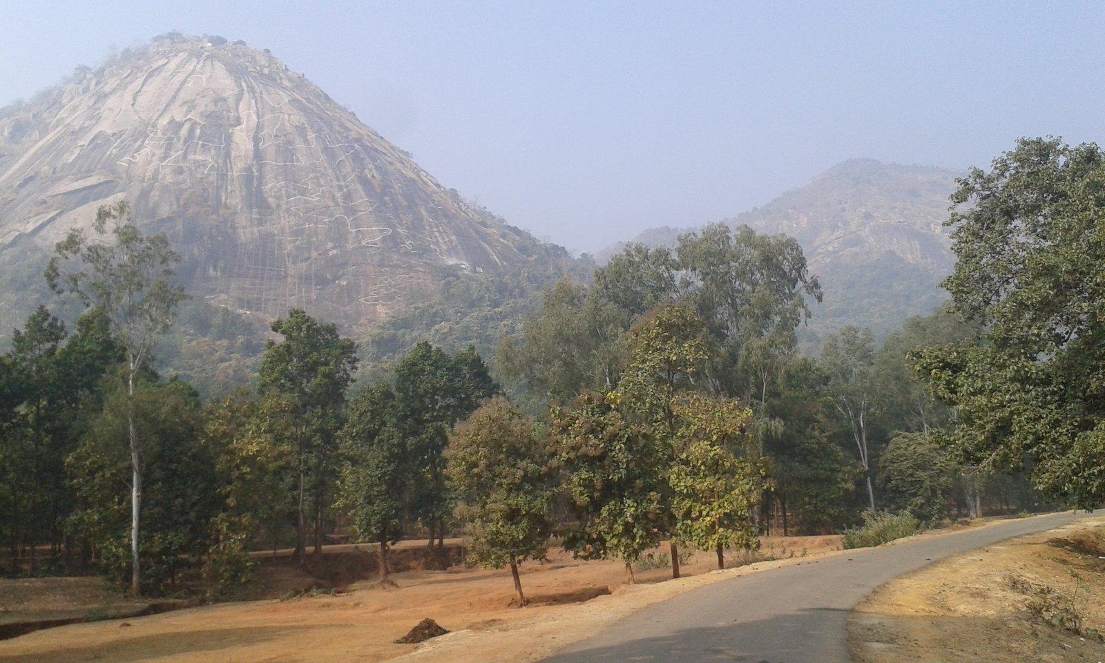
Gorgaburu is described as a conical hill of granite and gneiss and is ranked among the two highest summits of the range, at 677 m in one survey and 642 m in another. It rises east of the Matha forest, roughly 6 km from the resort as the crow flies, in the country around Pardi village and the small Paparkocha Dam.
No published trail description exists for Gorgaburu, and the approach roads are minor and poorly mapped. This is a hill to climb only with a local guide who knows the path, with plenty of daylight in hand.
Matha Buru and Pakhi Pahar: close to home
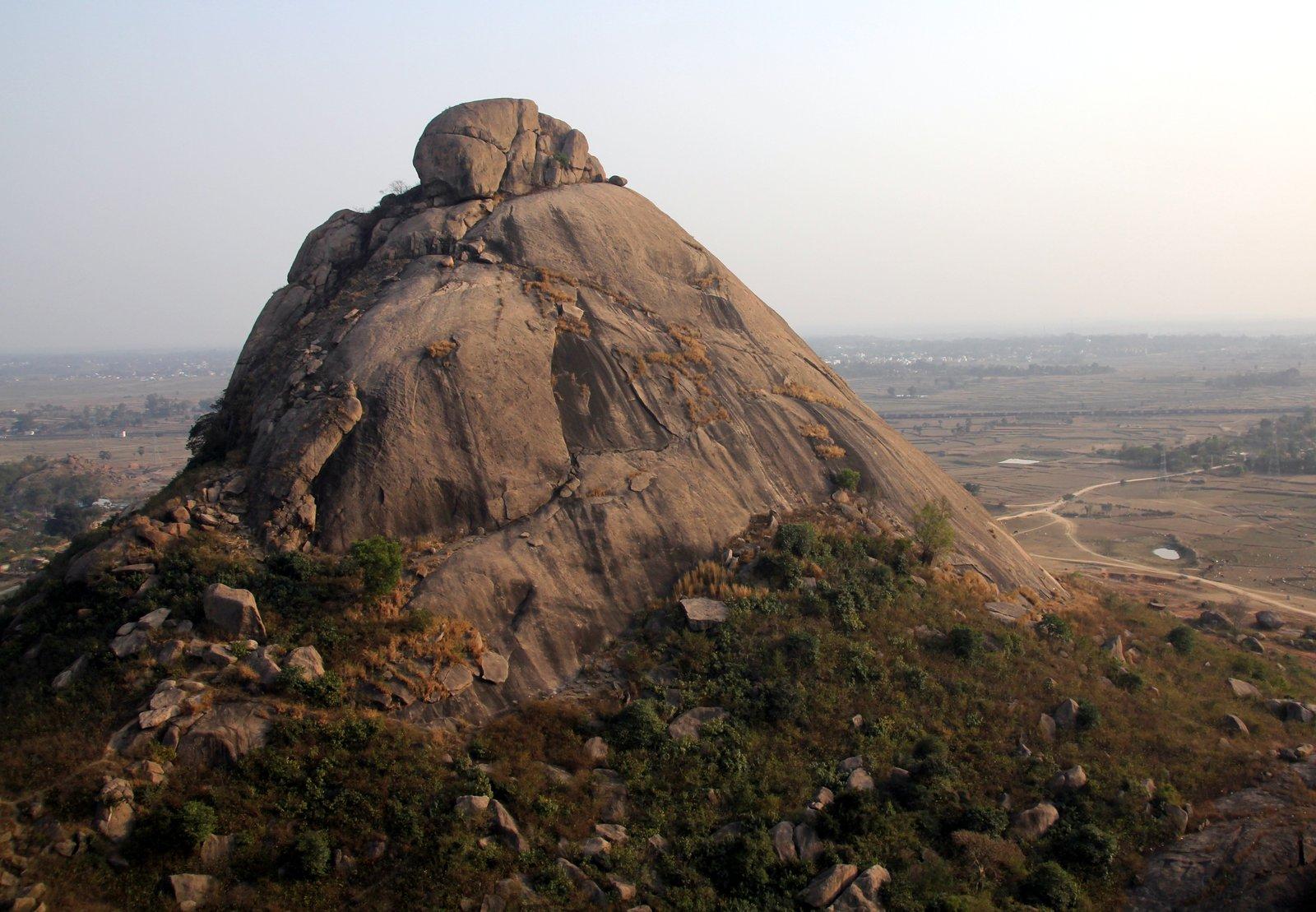
Matha Buru, 3 km from the resort, is the hill where Bengal's mountaineering clubs have trained rock climbers since about 1980. It is not a walking hill: no public trail to the top is documented, and its walls are for roped climbing on organised courses. Our guide to rock climbing in Purulia explains how those courses work.
Pakhi Pahar, 6.5 km away, makes a better first walk. Local women from self-help groups guide visitors among the carved boulders at the foot of the hill and into the forest around it. As of March 2023 the guide service charged ₹100 per vehicle (Sangbad Pratidin); check the current rate on arrival.
Mayur Pahar and the plateau walks
Mayur Pahar is the easiest summit in the range: a branch road reaches a parking area, and a flight of about 120 steps, without a handrail, climbs to an observation tower near 600 m. From Ajodhya hill top you can also walk to Sita Kund and the Ram Mandir, past the Bharat Sevashram Sangha and through the small village of Bagandi.
For sunrise, local guides drive early risers about 9 km across the plateau to Usuldungri, a hill village with a watch tower in the south-east of the range. The approach is on minor village roads.
Waterfall trails
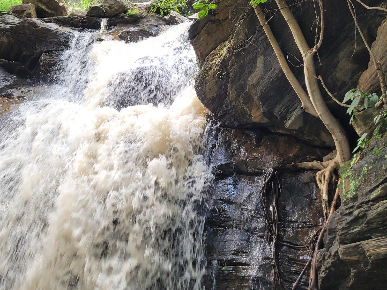
The approach to Bamni Falls is a steep descent on narrow, uneven steps, and reaching the lower falls means working your way down the hillside. Turga Falls is reached by a rocky, lightly wooded trail from where vehicles stop. Outlook Traveller warned that side paths around Turga and Bamni can quickly lead into wild country, so stay on the main track.
Further afield: Joychandi, Baranti and Garh Panchkot
In the north of the district, the district administration calls Joychandi Pahar "a very popular trekking spot". Several hundred steps lead past a ruined British-era semaphore tower to temples near the top. The hills around Baranti lake are also used for walks, and the forested Panchet Hill above Garh Panchkot is a winter favourite for walking; Outlook Traveller advises leaving that hill by late afternoon. Our north Purulia day trip guide covers all three.
When is the best time for trekking in Purulia?
November to February. India Meteorological Department normals for Purulia town (1991–2020) put the average January low at about 12 °C, with dry, clear days that are ideal for walking. By April and May the average daytime high is around 37–38 °C, and records have passed 46 °C.
March brings the red palash flowers, but walk early and finish by mid-morning. From June to September the rains turn the hills green, yet wet granite is treacherous and hill streams can rise suddenly: two bathing students were caught by a flash flood at Bamni Falls in July 2019.
Do you need a guide for trekking in the Ajodhya Hills?
For anything beyond Mayur Pahar or the Sita Kund walk, yes. Paths fork constantly, mobile coverage is patchy in parts of the hills, and a guide from the area will know which slopes are passable, where water collects and whether elephants have been seen nearby. A guide also keeps you from walking unknowingly through village fields or sacred sites.
The resort can arrange a local tour guide, sightseeing cab and driver on request; see our experiences. If you plan to camp, Outlook Traveller (2017) advised informing the police and the Forest Department at Ajodhya or Baghmundi first. We have not found any current permit system, so ask locally before you go.
Elephant safety on Purulia trails
Elephants from the Dalma forests in Jharkhand use these hills. In October 2018 The Telegraph reported a herd of 20 to 25 in the Ajodhya foothills, entering villages after sunset to feed on ripening paddy; a beat officer of the Matha forest range said the forests and hills gave them cover. In December 2025 The Statesman reported a herd of 42 from Dalma roaming the district, around 20 of them in the Jhalda range and 16 or 17 in the Balarampur range.
What to carry
Outlook Traveller's advice for the Ajodhya Hills still holds: good trekking boots, water, dry food, and at least five hours of daylight in reserve. Add a hat and sun protection, as the upper slopes are bare rock with little shade.
- At least 2 litres of water per person for a half-day climb; there is nowhere to refill on the hills.
- Shoes with a firm grip for granite slabs and loose stones.
- A small first-aid kit, a torch and a charged phone, even for day walks.
- Light layers in December and January, when early mornings are cold.
Leave no trace in the Ajodhya Hills
These hills are home to Santal, Bhumij and other communities who graze cattle and gather firewood, leaves and medicinal plants here. A villager living beside the Purulia Pumped Storage Project told Mongabay in 2019 that plastic left by picnickers at the dam had been eaten by livestock, which fell ill and died. At Pakhi Pahar, the women guides clear plastic from the forest every morning.
- Carry every wrapper and bottle back out.
- No fires in the forest; the dry leaf litter of winter and spring burns easily.
- Keep music off and voices low, and stay on existing paths.
- Ask before photographing people or homes, and stay clear of sacred hills, groves and stones unless invited.
Sample trekking days from the foot of Matha Buru
- Easy half day: a guided morning walk at Pakhi Pahar, then a slow drive back past the Matha forest.
- Plateau day: Mayur Pahar's steps in the early morning, a walk to Sita Kund from Ajodhya hill top (20 km from the resort), then the trail to Bamni Falls if your knees are good.
- Summit day: an early start for Khairabera (22 km), Chemtaburu with a guide, and an afternoon by the reservoir.
For birds along the way, see our birdwatching guide, and for the trees and animals you will walk among, read about the forests and wildlife of the Ajodhya Hills.