Full day · Ajodhya circuit
- Lower Dam11 km
- Upper Dam16 km
- Marble Lake19 km
- Bamni Falls13 km
- Thurga Falls11 km
- Ajodhya Hill Top20 km
- Mayur Pahar20 km

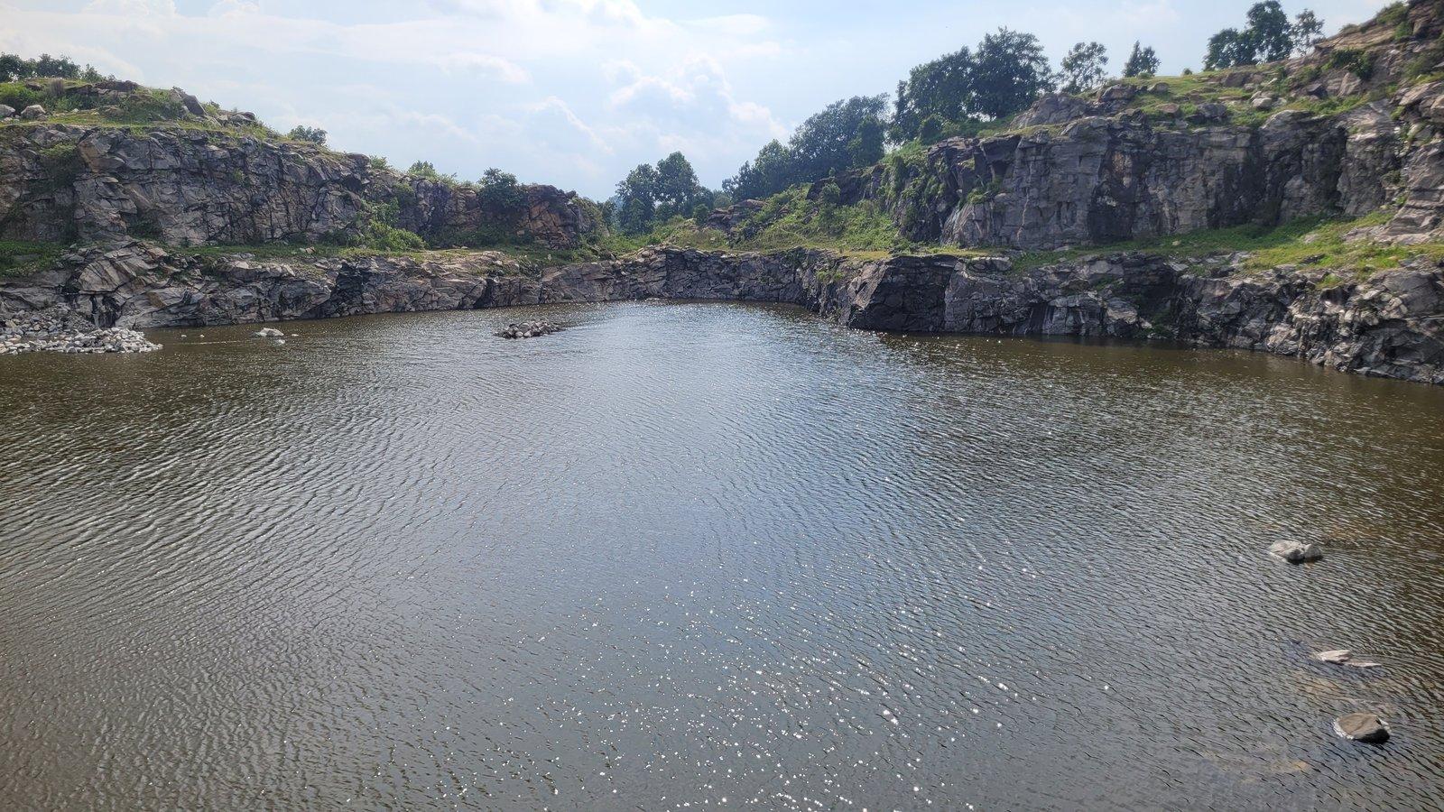
Photo: WikiForRay, CC0 1.0
Lake
A deep blue lake in the quarry cut for the hill dams.
Overview
Lake
Marble Lake fills a pit left by blasting rock on the Ajodhya plateau, where stone was cut for the Purulia Pumped Storage Project. Steep, banded rock walls drop into deep, still water that turns a strong blue under a clear sky, and it has become one of the most popular stops on the hill circuit. The district administration lists it as Durga Bera.
The lake lies a short way off the road between Ajodhya hill top and Bamni Falls. Blasting opened a deep gash in the rock, springs filled it, and the result is a small lake about 40 feet (12 m) deep, still ringed by the broken stone that was dug out. The district calls it Nil Jal for its colour; local people also know it as Patal Dam and Neel Dam.
It is small, about 2 hectares of water by a 2023 field survey, but the setting is striking: dark water at the bottom of a deep cut, high rock walls above it and the long forested ridge behind. Bengali visitors often compare it to a miniature Grand Canyon, and it draws crowds in the season.
The quarry faces are of real interest to geologists. They expose migmatite banded in light and dark layers, formed when the parent rock partly melted at very high temperatures, cut by younger dolerite dykes and by pegmatite and quartz veins with coarse crystals of quartz, feldspar and mica. Some quartz veins swell and pinch along their length. The 2023 study rated it the only geologically 'unique' lake in the hills.
Past & present
History & stories
Marble Lake is a by-product of engineering. Stone for the Purulia Pumped Storage Project, built between 2002 and 2007, was blasted out of the hillside here, and the abandoned pit filled with water. Outlook Traveller says the stone went into irrigation dams instead; the district administration, Sangbad Pratidin and a 2023 geological study all link it to the hydroelectric project.
In June 2019 the then district magistrate, Rahul Majumdar, visited the lake and announced plans for a cafeteria and a watch tower, to be run by a self-help group or a private operator. He also asked engineers to study whether its water could be treated and piped to villages on the dry plateau. We could not confirm what has since been built.
When you're there
See & do
From the rocks around the edge you look straight down into the water. The blue is deepest on a clear, bright day.
Look for the light-and-dark banding in the rock and the darker dolerite dykes that cut across it, laid bare by the blasting.
Bamni Falls is just down the road, and Turga Falls and the Upper Dam are on the same hill road, so the lake usually forms part of a longer round.
Gallery
Photos
Photos coming soon
We're putting together our own photographs of Marble Lake. Been there with us? We'd love to see yours.
Getting there
From Rangamati
Marble Lake is 19 km by road from the resort, to the north. A local guide, sightseeing cab or driver can be arranged on request.
Before you go
Through the year
Seasons & festivals
March – June
Hot and dry from April. Clear skies bring out the blue of the water.
July – September
Heavy rain can raise the hill streams suddenly, Outlook Traveller warns; take care on wet rock around the rim.
October – February
October to March is the main season, cool and dry, with the most visitors.
Good to know
Questions
About 19 km by road, via Baghmundi and the hill road. The resort can arrange a sightseeing cab, driver or guide on request.
No. It formed in a pit blasted out to quarry stone for the hydroelectric project, which then filled with spring water.
The name is a popular one. The district administration describes the stone as hard igneous rock, and a 2023 geological study describes banded migmatite cut by dolerite dykes and pegmatite veins.
It is not a swimming spot. The district gives its depth as about 40 feet, and the water lies at the foot of steep rock walls.
Yes. The district administration's page for Durga Bera describes the same 40-foot-deep blue lake in a quarry for the hydro project, and the 2023 study lists it as 'Durgabera dam (Marble lake)'.
Yes. It lies on the way to Bamni Falls from the hill top, so the two are usually seen together, along with Turga Falls and the Upper Dam.
Make a day of it
Close by
Other places close to this one, so you can see a few in a single trip.
On our suggested itineraries
From our travel journal
Places to see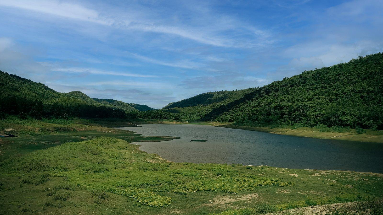 Nature & outdoors
 Trip planning
Sources: sangbadpratidin.in · outlooktraveller.com · bn.wikipedia.org · bangla.aajtak.in · outlookindia.com · openstreetmap.org · purulia.gov.in · mdpi.com · wbsedcl.in · en.wikipedia.org · openstreetmap.org · router.project-osrm.org
Rangamati is your base for the Ajodhya hills — tell us your dates and we'll plan the drive.